Union Territories (UTs)
Top Famous Indian Beaches
Famous Lakes
Temples
National Parks
Museums
Waterfalls
Wildlife Sanctuaries
Zoos
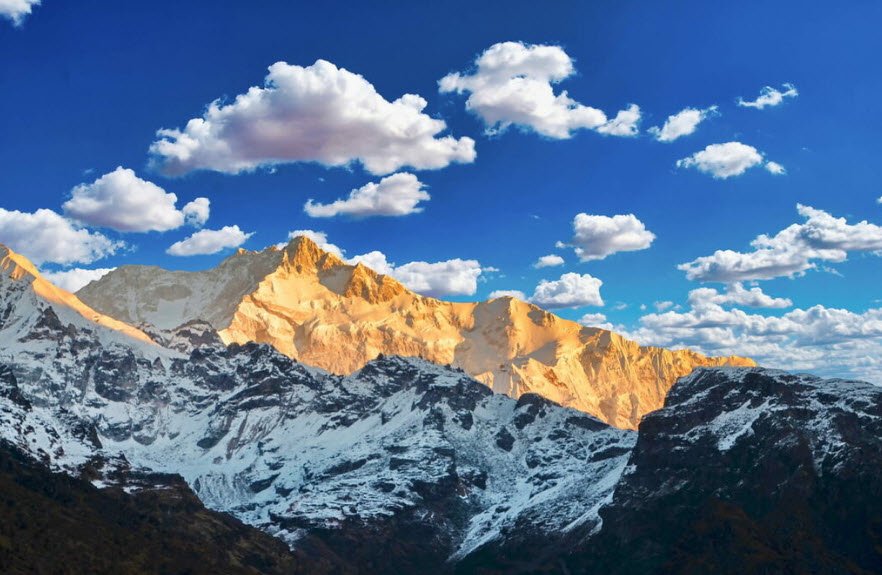
19 Mountain Ranges of India You Need To Know
India is home to 19 major mountain ranges that have peaks of over 1000 metres. The most famous and the highest mountain range of India is the Himalayan range.
09 August 2022 - By Vishal
19 Mountain Ranges of India You Need To Know
India is home to 19 major mountain ranges that have peaks of over 1000 metres. The most famous and the highest mountain range of India is the Himalayan range.
1. Karakoram Range
- A Trans-Himalayan Range that starts from Pamir Knot and spreads across borders of Afghanistan, Tajikistan, Pakistan, India and China. Thus, it is of Geo-political significance.
- Between the Great Himalayas and the Karakoram Ranges is a Cold Desert.
- Highest Peak- K2 (8,611m) is the second-highest of the world after Mount Everest
- Glaciers- Siachen, Baifo, Baltoro.

2. Ladakh Range
- A Trans-Himalayan Range between the Shyok river and the Indus River valleys.
- The southern extension of the Ladakh Range is called Kailash Range and lies in Tibet.
- Major District- Leh
- Passes- Khardung La (LehShyok and Numbra Valley), Chang La (Leh-Pangong Salt Lake), Chorbat La (Ladakh-Baltistan).

3. Zaskar Range
- A Trans-Himalayan Range south of Ladakh range.
- Nanga Parbat is its westmost point.
- Highest Peak- Kamet (Chamoli District of Uttarakhand).
- Passes- Photu La (SrinagarLeh Highway).

4. Pir Panjal Range
- Lesser Himalayas separates Jammu from Kashmir.
- Karewa formation helps Zafran saffron in Kashmir.
- Peaks- Indrasan, DeoTibba
- Passes- Haji Pir Pass (Poonch-Uri), Pir Panjal Pass (Kashmir-Rajouri), Banihal Pass (Jawahar Tunnel).

5. Shiwalik Range
- Outer Himalayas that ranges from Indus River to Brahmaputra River
- Duar formations help tea plantation in Darjiling.
- Prominent ethnic tribes in Arunanchal Prades West to East are Monpa, Daffla, Abor, Mishmi, Nishi and Naga.

6. Garo Hills
- Named after majorly inhabited Garo tribe.
- Located in the western part of Meghalayan Plateau.
- Major Town- Tura
- Highest Peak- Nokrek (1,412m)
- National CitrusGene Sanctuary-cum-Biosphere Reserve is located at Nokrek.
- Balpakram National Wildlife Park, South of Garo Hills.

7. Khasi Hills
- Named after majorly inhabited Khasi tribe.
- Located in the middle part of Meghalayan Plateau is its Highest point.
- Major Town- Shillong (East Khasi Hills), Sohra (Cherrapunjee), Mawsynram, Mawlynnong (Cleanest Village in India).

8. Jaintia Hills
- Named after majorly inhabited Jaintia tribe.
- Located in the eastern part of Meghalayan Plateau.
- Waterfalls- Krang Suri Fall, Tyrshi Falls.

9. Patkai Bum
- Located in the Northern part of Purvanchal Range.
- Forms border between India and Myanmar.
- Passes- Pangsau Pass (India-Mayanmar).

10. Naga Hills
- Part of Purvanchal Range
- Forms border between India and Myanmar.
- Highest Peak- Mt Saramati (3,840m)
- Major District- Kiphire

11. Manipur Hills
- Part of Purvanchal Range.
- Bounded by Nagaland to the North, Myanmar to the East, Mizoram to the South and Assam to the West.
- Major Tribe- Meitei, Pangals, Kuki, Naga.
- Famous for Loktak Lake and Keibul Lamjao National Park (Sangai Deer).

12. Mizo/Lushai Hills
- The southernmost part of Purvanchal Range.
- Highest Peak- Phawnpuri (2,157m Blue Mountain).
- Tropic of Cancer passes through it.
- Phawngpuri National Park.

13. Dhauladhar Range
- Part of Lesser Himalayas
- Major Hillsations- Shimla, Kullu Manali, Dalhousie, Chamba, Dharmshala.

14. Aravalli Range
- Running southwest direction through- Delhi, Haryana, Rajasthan and Gujrat.
- Oldest range of Fold Mountains in India.
- Contain Copper Mines and Dolomite.
- Source of rivers Banas (Rajsamand), Luni (Pushkar), Sahibi (Sikar) and Sabarmati (Udaipur).
- Highest Peak- Guru Shikhar of Mt Abu (1,722m) in Sirohi District.

15. Girnar Range
- Located in the southern Kathiawar Peninsula.
- One of Jain Tirtha as Nirvana Bhumi of 22nd Tirthankara Lord Neminatha
- Gir National Park is known for its Asiatic Lions.
- Major District- Junagarh

16. Kaimur Hills
- Located at the eastern part of Vindhya Range, divides the rivers Son and Tamsa (Tons)

17. Vindhya Range
- Part of Central Highlands and runs north of Narmada.
- Source of rivers Chambal, Betwa, Ken and Tamsa.
- Highest Point- Sad-bhawna Shikhar (752m)
- Tropic of Cancer passes through it.

18. Satpura Range
- Part of Central Highlands and runs south of Narmada.
- Separates Indo-Gangetic Plains and Deccan Plateau.
- Source of two major West flowing rivers- Narmada (Amarkantak) and Tapi (Betul).
- Rich in Eco-tourism with several National Parks and Reserves.
- Structural parts- Rajpipla Hills, Gawilgarh Hills, Khandwa Gap, Mahadeo Hills and Maikala Hills.

19. Maikala Hills
- Lies on Eastern Satpura Range in Chattisgarh and adjoining Madhya Pradesh.
- Bauxite deposits found here.
- Major tribes inhabitedBaigas and Gonds.
- Kanha National Park and Achanakmar Wildlife Sanctuary are located here.


Vishal
Author


